

Land’s End Trail
View PhotosLand’s End Trail
Difficulty Rating:
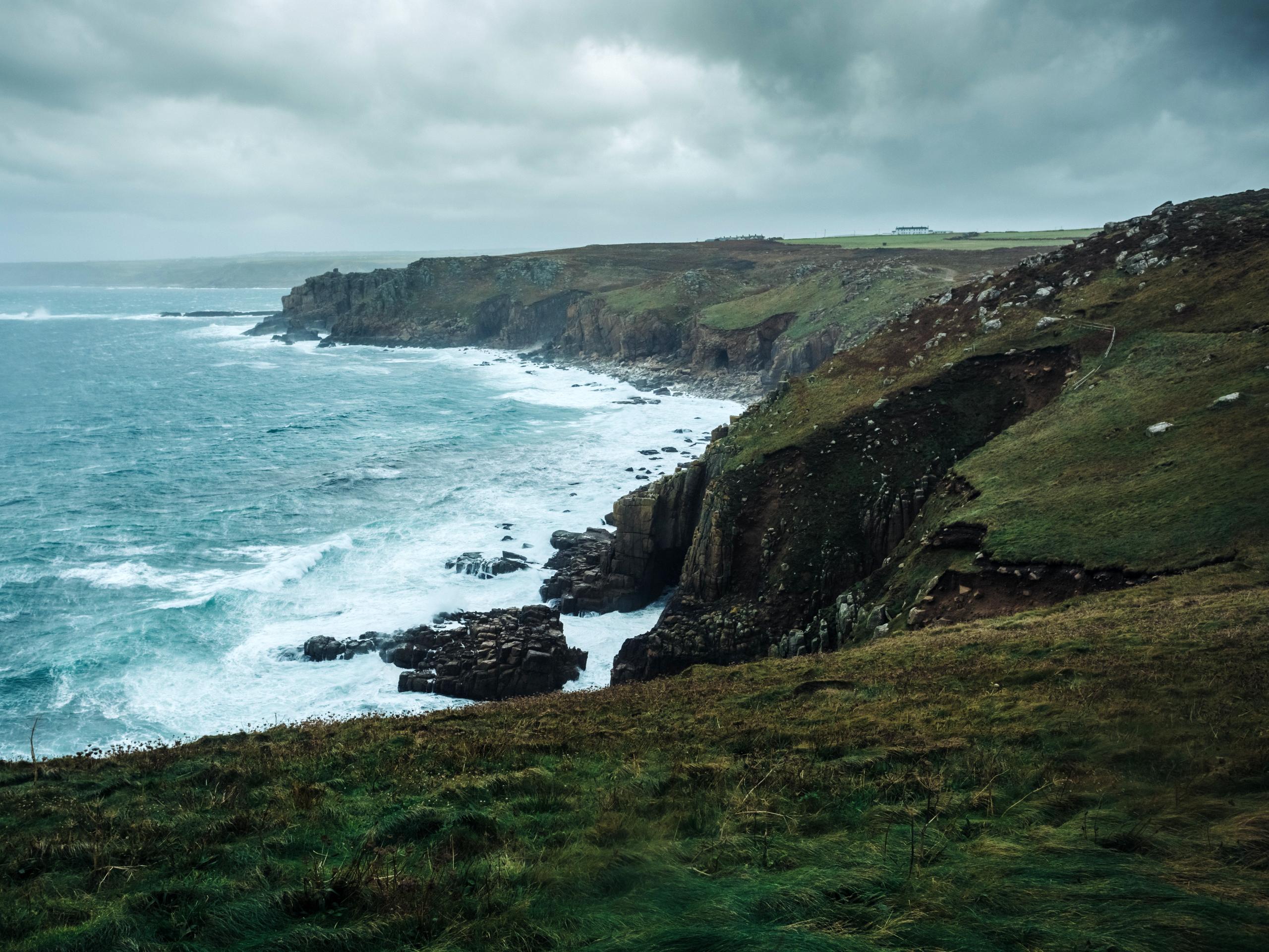
The Land’s End Trail is a beautifully scenic adventure that will take you along the breathtaking landscape of the Cornish coast. While out walking the trail, you will pass by the various exhibits and attractions at Land’s End, before exploring the rugged coast for yourself at the westernmost point of England. This is a spectacular excursion that is perfectly suited for walkers of all ages and skill levels.
Getting there
The trailhead for the Land’s End Trail can be found at the Land’s End car park, located at the end of the A30.
About
| Backcountry Campground | No |
| When to do | Year-Round |
| Pets allowed | Yes - On Leash |
| Family friendly | Yes |
| Route Signage | Average |
| Crowd Levels | High |
| Route Type | Lollipop |
Land’s End Trail
Elevation Graph
Weather
Land’s End Trail Description:
The Land’s End Trail follows along a section of the Cornish coast that features some truly stunning scenery. This, in addition to the fact that it is the most westerly point of mainland England, means that it is a popular route that will see a large volume of foot traffic. Be sure to book your parking in advance and arrive early to beat out the crowds. While visiting Land’s End is free, parking for the day will cost you £7 per day. Make sure to wear proper walking boots for this adventure and bring a raincoat or windbreaker to fend off the elements. Additionally, there are severe drop offs along the coast, so remember to exercise caution with children and dogs.
Although it may be a busy excursion, the stunning coastal views at Land’s End are truly remarkable and are something that you will not want to miss. After passing by the Land’s End complex of hotels, cafes, and exhibits, you will be able to explore the breathtaking cliffs and coves that make this area so beautiful. If you find yourself in Cornwall, you will definitely want to check out this amazing attraction.
Setting out from the car park, you will make your way towards the Land’s End complex and turn left along the track leading towards the south. Follow this for the next 0.2mi and cross over the bridge next to Greeb Farm, turning left after 170ft to make your way south along the coast. Take your time to appreciate the rugged and beautiful shoreline, as you loop around the southernmost portion of the route at Pordenack Point and return back to the junction where you had turned off.
Here, you will head left, followed by the next right in order to make your way north along the coast. After 0.2mi, you will arrive back at the Land’s End complex and pass by the Land’s End Hotel, beside which you will find several amazing viewpoints overlooking the shoreline and the Celtic Sea. Once you have reached Penwith House, turn back along the trail for 0.1mi and keep left to return to the car park.
At this point, you will make your way north past the public toilets and turn left at the model village in order to pick up the footpath. At the first junction, take the path on the right and continue walking to the northeast for the next 0.7mi, as you take in some more breathtaking views of the Cornish coast. Shortly after passing the ruins of Maen Castle on your left, you will come to a viewpoint overlooking the Mayon Cliffs and a fascinating shipwreck on the rocks below. From here, you will simply retrace your steps along the trail to return to the car park where you began your adventure along the Land’s End Trail.
Trail Highlights
Land’s End
Located along the Cornish coast, Land’s End is a headland along the Penwith Peninsula and is bordered by the English Channel and Celtic Sea. Famous for its stunning coastal landscape, Land’s End is the westernmost point of mainland England; however, it is not the westernmost point of Great Britain.
Frequently Asked Questions
Do you have to pay to visit Land’s End?
The stunning coastal experience at Land’s End is a free experience for visitors, although you will need to pay for parking.
Why is it called Land’s End?
There are many different nicknames for the area of the Cornish coast known as Land’s End, with many being hundreds of years old. The oldest of such names, Penwith Steort, dates back to 997 CE and is Cornish for ‘extreme end.’
Insider Hints
Be sure to wear comfortable walking footwear.
This trail is exposed to coastal elements, such as strong winds and rain. Make sure to bring adequate clothing for the conditions.
Parking at the trailhead should be booked in advance to secure a space. The cost is £7 per day.
Similar hikes to the Land’s End Trail hike

Restronguet Passage Circular Walk
The Restronguet Passage Circular Walk is a fantastic outdoor excursion in Cornwall that offers beautifully scenic views overlooking a number…

Crantock and The Gannel Circular Walk
The Crantock and The Gannel Circular Walk is a beautifully scenic adventure near Newquay, Cornwall that will lead you through…

Egloshayle Circular Walk
The Egloshayle Circular Walk is a great outdoor excursion set in the Cornish countryside that will expose you to a…


Comments