
Stamford Bridge and River Derwent Walk
View Photos
Stamford Bridge and River Derwent Walk
Difficulty Rating:
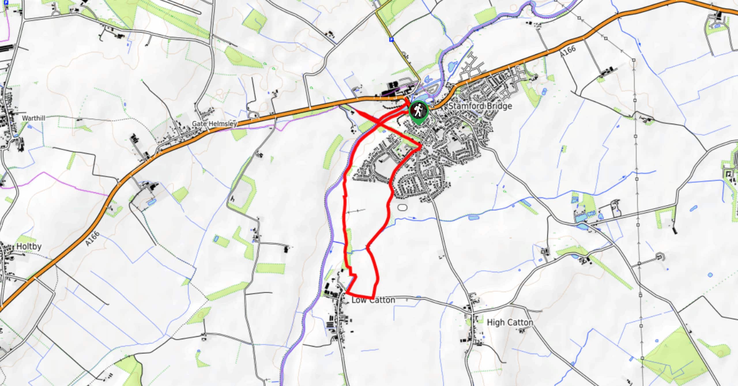
The Stamford Bridge and River Derwent Walk is a beautifully scenic adventure to the southwest of the Howardian Hills AONB that will take you through the countryside and along the banks of the river. While out walking the trail, you will leave the town behind and walk along the water’s edge, looping around the open fields on the return leg that will take you to the famous 1066 CE battle site of Stamford Bridge. This is a laid back adventure with easy terrain, beautiful views, and fascinating local history.
Getting there
The trailhead for the Stamford Bridge and River Derwent Walk can be found at the Shallows Free Car Park on Viking Road in Stamford Bridge.

About
| Backcountry Campground | No |
| When to do | March-October |
| Pets allowed | Yes - On Leash |
| Family friendly | Yes |
| Route Signage | Average |
| Crowd Levels | Moderate |
| Route Type | Circuit |
Stamford Bridge and River Derwent Walk
Elevation Graph
Weather
Stamford Bridge and River Derwent Walk Description
If you enjoy visiting interesting historical locations and taking in some stunning waterside views, then you will certainly want to check out the Stamford Bridge and River Derwent Walk in Yorkshire. Not only will you be able to relax in the serene riverside setting, but you will also be able to explore the site of the famous 1066 CE Battle of Stamford Bridge, when King Harold Godwinson defeated the Norse King Harald Hardrada and drove the Vikings from England.
Setting out from the car park, you will make your way to the southwest and follow closely along the banks of the River Derwent, enjoying the waterside views as you leave the town behind. After reaching Church Lane on the edge of Low Catton, you will head to the southeast, before turning to the north to complete the loop through the countryside.
At the old rail station, turn to the northwest and make your way over the viaduct that spans the river, turning to the northeast to walk along the water’s edge on the way to Stamford Bridge. While this isn’t the original wooden bridge from the time of the battle, it does sit on the same site. From here, you will head across the bridge and make your way back into the trailhead where you began.
Similar hikes to the Stamford Bridge and River Derwent Walk hike
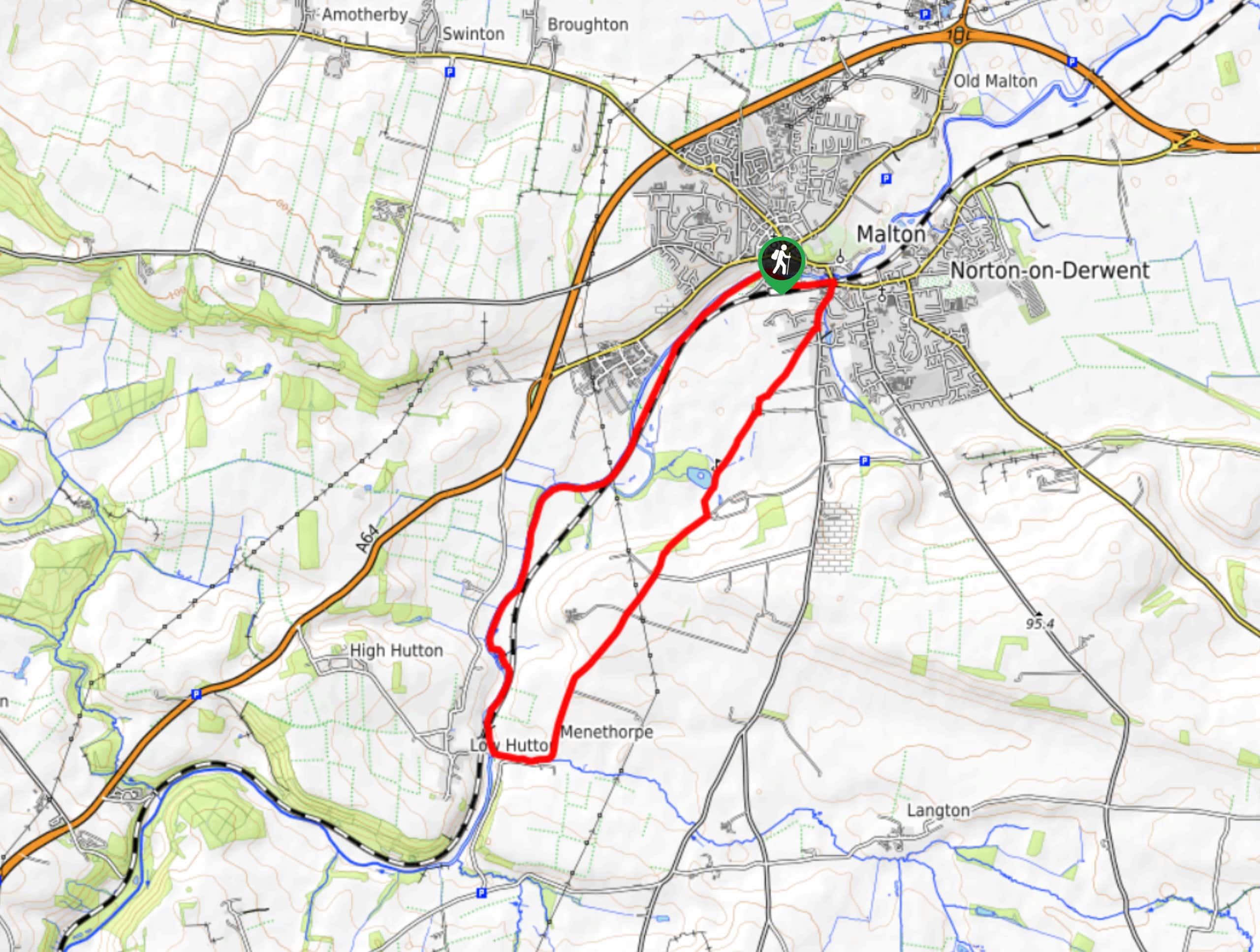
Norton and Menethorpe Walk
The Norton and Menethorpe Walk is a fun, but slightly overgrown route just east of the Howardian Hills AONB that…
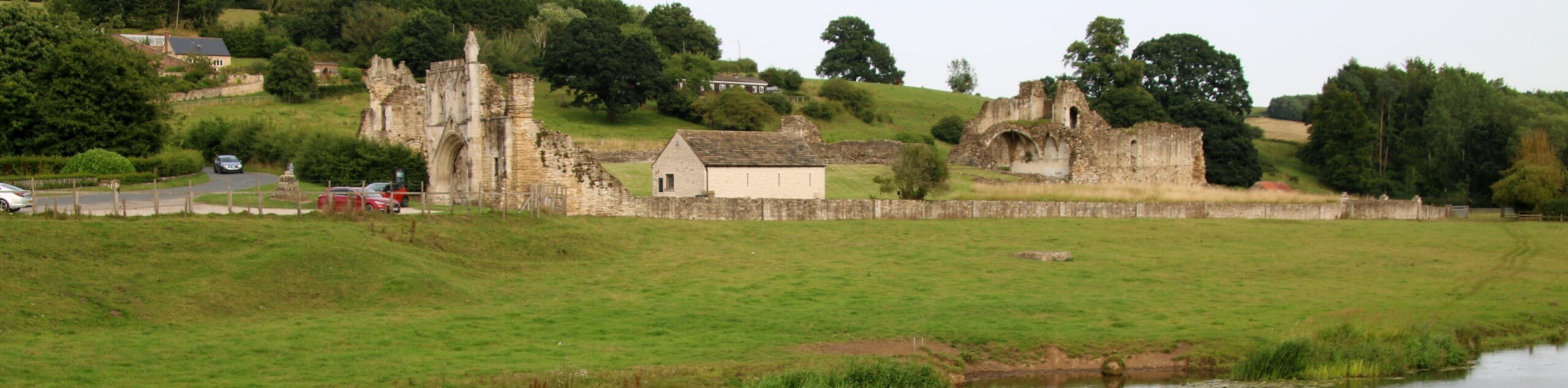
Kirkham Priory and River Derwent Walk
The Kirkham Priory and River Derwent Walk is a fantastic adventure in the Howardian Hills AONB that will showcase the…
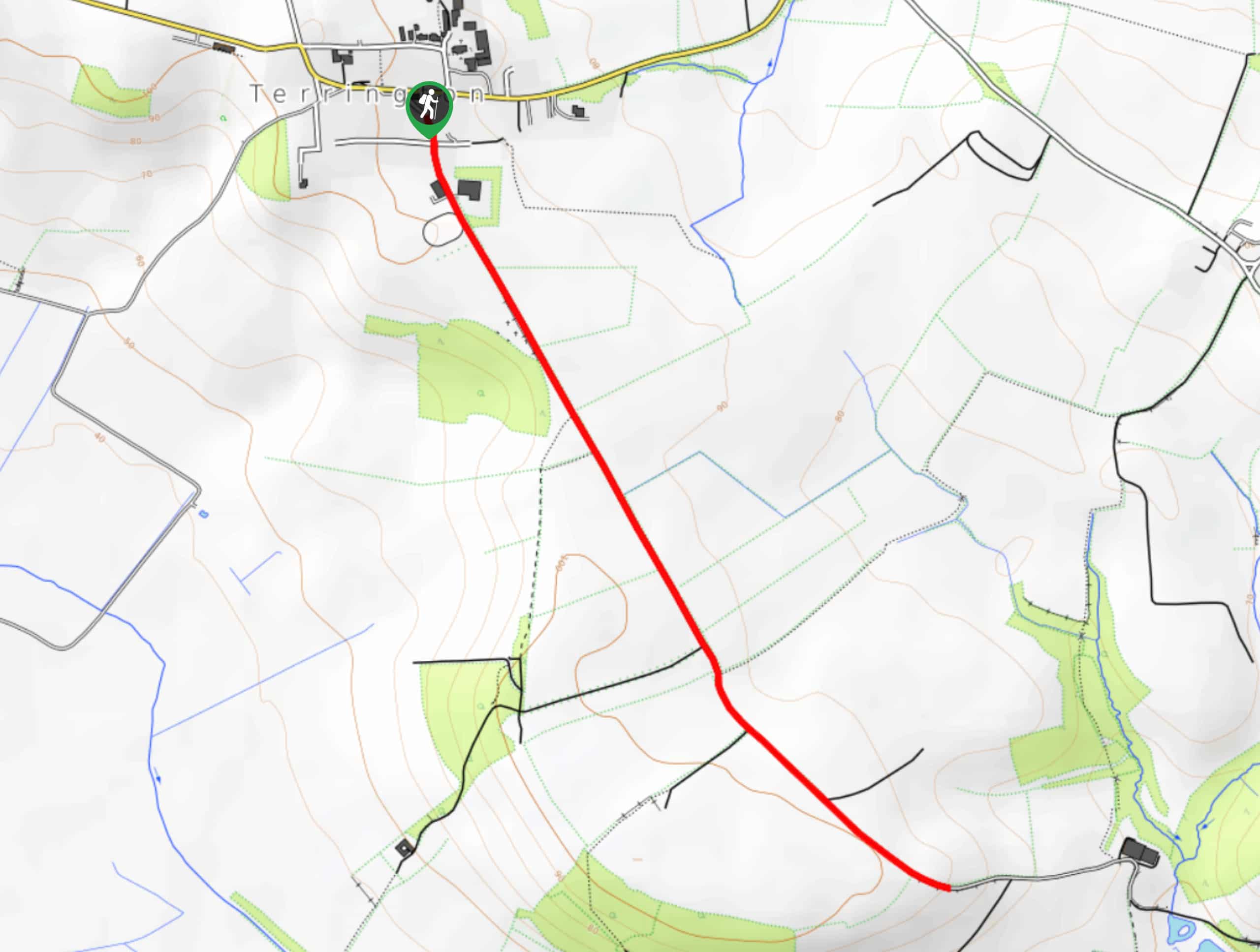
Terrington Mowthorpe Lane Walk
The Terrington Mowthorpe Lane Walk is a short but scenic walking route in the Howardian Hills AONB that features easy…
Comments