Redstreak Creek Trail
View Photos
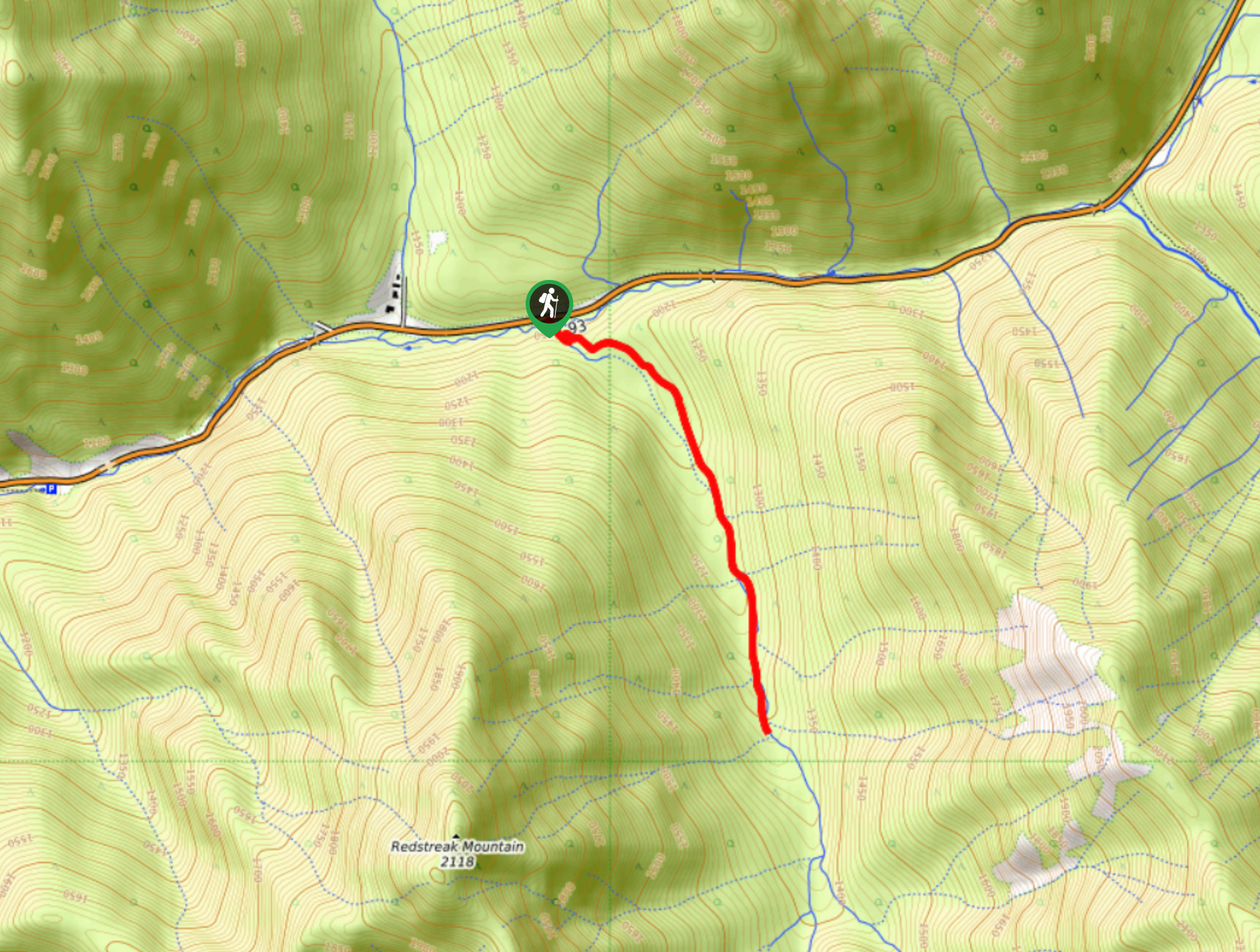
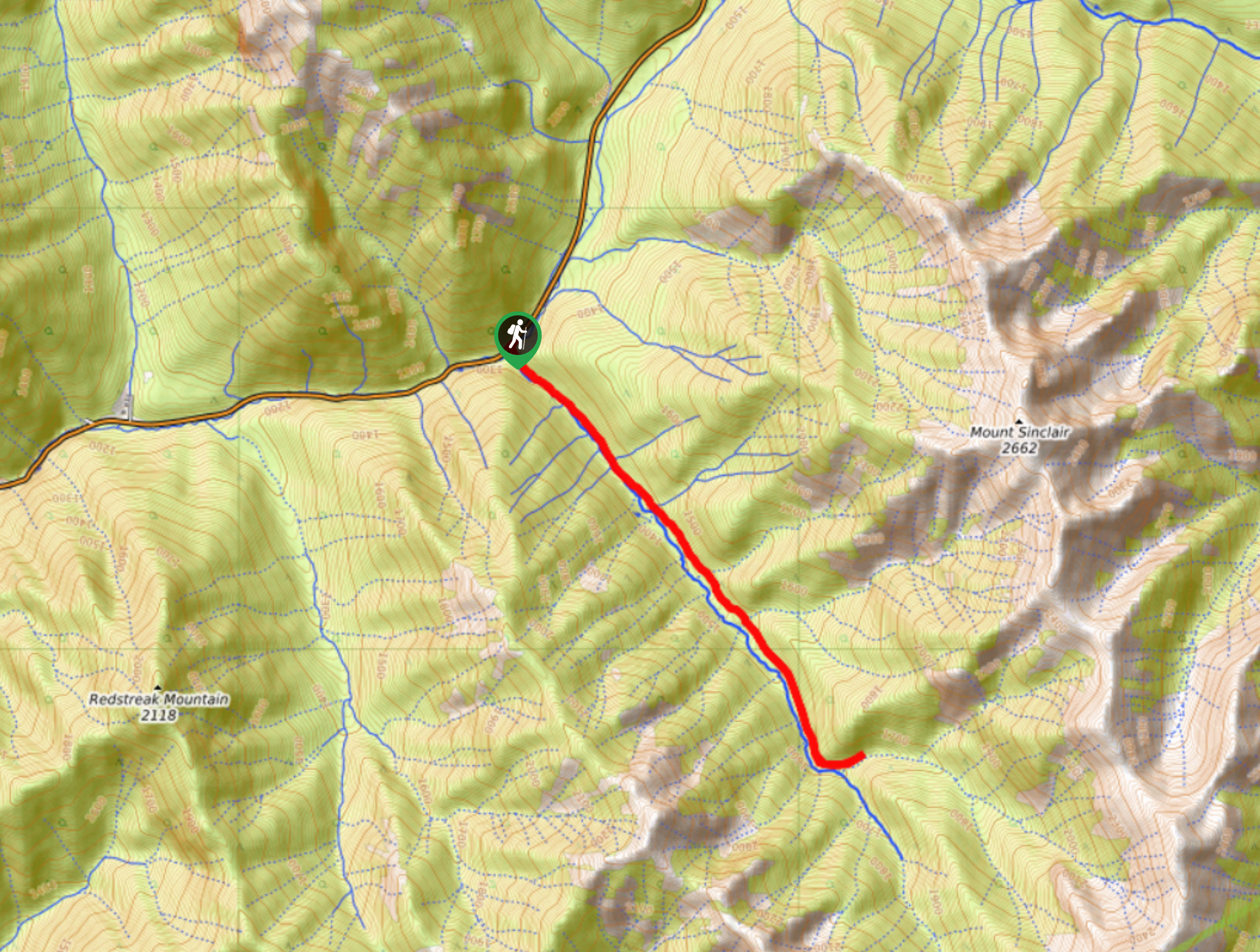
Redstreak Creek Trail
Difficulty Rating:
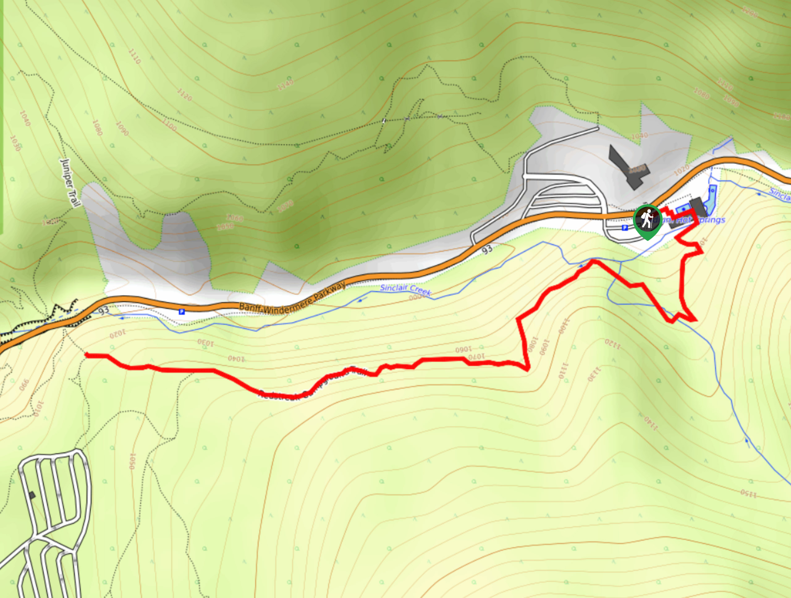
Hiking the Redstreak Creek Trail is a quick and relatively easy hike that features several steep sections of terrain and a peaceful forest setting. While out on the trail, you will hike through the tranquil woodland atmosphere along Redstreak Creek, eventually reaching the signposted end of the trail with a nice sitting area to pause for a quick rest. Although this trail is generally well-maintained, severe weather will see a fair amount of blowdown along the trail.
Getting there
To access the trailhead for the Redstreak Creek Trail from Radium Hot Springs, make your way northeast along BC-93 for 3.5mi where you will find the trail on the right.

About
| When to do | July-October |
| Backcountry Campsites | No |
| Pets allowed | Yes - On Leash |
| Family friendly | Yes |
| Route Signage | Average |
| Crowd Levels | Low |
| Route Type | Out and back |
Redstreak Creek Trail
Elevation Graph
Weather
Redstreak Creek Trail Description
The Redstreak Creek Trail isn’t an overly popular route in Kootenay National Park; however, those hikers that do make their may onto the trail praise its amazing forest setting and variety in terms of terrain difficulty. Setting out from the trailhead, you will make your way into the dense forest and cross over Sinclair Creek, following closely along the waters of Redstreak Creek as it cuts through the forest to the southeast. There is a bit of steep terrain along this first portion of the route, but it will even out into a pleasant stroll where you can relax in the peaceful woodland atmosphere. Eventually, you climb another slightly steeper section of trail before arriving at the marked end of the trail. Hang out here for a bit and enjoy the serene creekside setting before retracing your steps through the forest on the return to the trailhead.
Similar hikes to the Redstreak Creek Trail hike
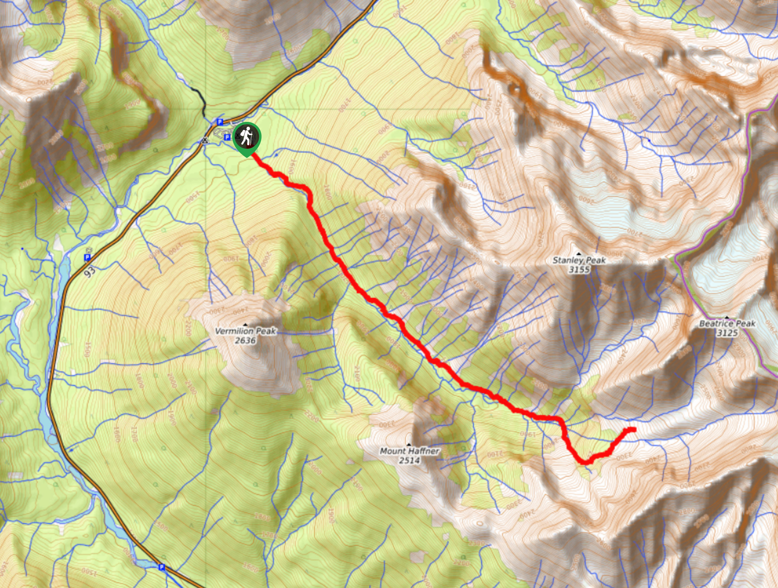
Haffner Creek Trail
The Haffner Creek Trail is a lengthy hiking route that will lead you along a winding creek for some scenic…
Kimpton Creek Trail
The Kimpton Creek Trail would be a nice and easy hike through the forest along a charming creek if it…
Redstreak Campground Trail
The Redstreak Campground Trail is a quick and easy hiking route in the southern portion of Kootenay National Park that…
Comments