

Myra Bellevue Trail
View PhotosMyra Bellevue Trail
Difficulty Rating:
The Myra Bellevue Trail takes you around a wide loop, granting far-away unveilings of Okanagan Lake nestled at the forefront of rolling hills. This is an excellent route for locals looking for a change of hike as it immerses you in nature and gets your body moving. It’s also a multi-use trail, so expect to encounter animal friends like horses and dogs, as well as fellow adventurers choosing to take this route via mountain biking instead of hiking.
Getting there
To get to the start of the Myra Bellevue Trail from Kelowna, head to Bedford Road, which quickly veers off into Stewart Road. Continue straight until you get to Myra-Bellevue Provincial Park Day Use Area and park in the parking lot.
About
| When to do | Year-round |
| Backcountry Campsites | No |
| Pets allowed | Yes - On Leash |
| Family friendly | Yes |
| Route Signage | Average |
| Crowd Levels | Moderate |
| Route Type | Lollipop |
Myra Bellevue Trail
Elevation Graph
Weather
Myra Bellevue Trail Description
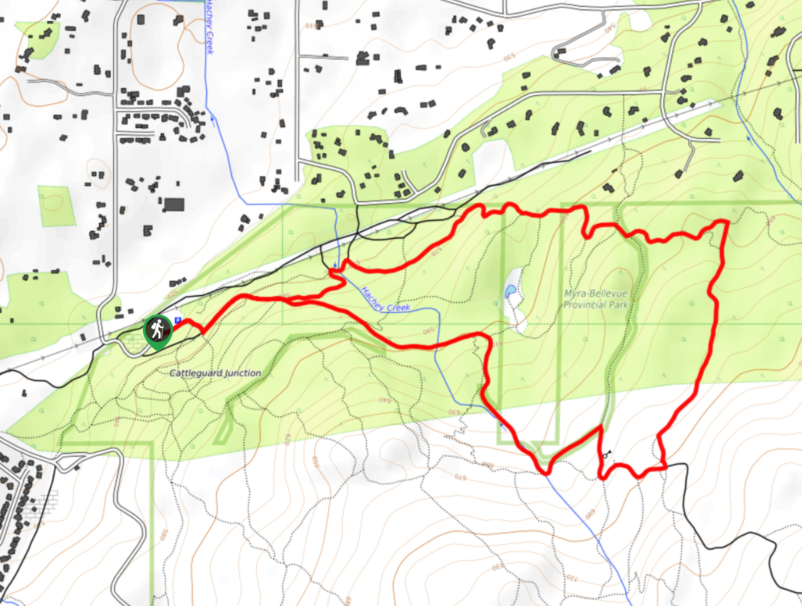
The Myra Bellevue Trail in the Okanagan Valley is a moderately trafficked, lollipop trail that unveils far-away views of Okanagan Lake. The out-and-back portion starts from the parking lot before the loop begins. You’ll start on Bench Road before taking a left to meet up with Lost Lake Trail. This hike’s loop portion will begin when you veer off Lost Lake Trail and take Fairline Trail. Follow the loop clockwise until you reach a junction for Galloping trail. Continue making your way around the loop, passing by Rose Lookout. Right after Rose Lookout, go right onto Lost Lake Trail and then take a quick left to stay on Lost Lake Trail. Continue following this trail until you meet up with the same path you walked at the start of this hike, which will take you back to the parking lot.
Similar hikes to the Myra Bellevue Trail hike

Glen Canyon Greenway Trail
The Glen Canyon Greenway Trail, located in West Kelowna, is a family-friendly hike that blends flat, easy-going terrain with more…

Denison Lake Trail
When summer rolls around, the Okanagan Valley’s scorching hot weather propels most to flock to the beaches, but why not…

Naramata Creek Falls Hike
The Naramata Creek Falls Hike winds through a thick forested area along a semi-maintained trail that forces you to cross…


Comments