

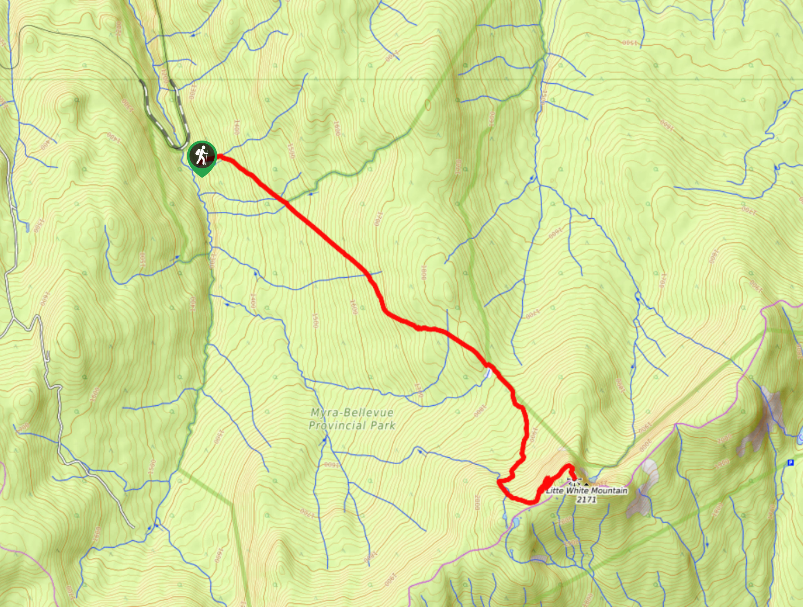
Little White Mountain Hike
View PhotosLittle White Mountain Hike
Difficulty Rating:
The Little White Mountain Hike is a lightly trafficked route that immerses you in secluded scenery and pushes you to phenomenal views of the Okanagan Valley stretched across the landscape below. This is a challenging route that rewards at the top!
Getting there
To get to the start of the Little White Mountain Hike from Kelowna, head to McCulloch Road before turning onto the unpaved June Springs Forestry Road. Continue along this road until Kettle Valley Railway Trail. Take a right and drive for 4.3mi towards Bellevue Trestle. Pass by Bellevue Trestle, which will sit on your right, and continue straight before swerving left to the parking lot for Upper Crawford Trail. The last section of this road is narrow and takes you along the edge of a cliff.
About
| When to do | July - October |
| Backcountry Campsites | No |
| Pets allowed | Yes - On Leash |
| Family friendly | No |
| Route Signage | Poor |
| Crowd Levels | Low |
| Route Type | Out and back |
Little White Mountain Hike
Elevation Graph
Weather
Little White Mountain Hike Description
The Little White Mountain Hike in the Okanagan Valley is a lightly trafficked half-day hike, which follows Upper Crawford Trail and takes you to an incredible view of the mountainscape rolling into the horizon. The trail is maintained but overgrown in some areas and can mimic a creek when it’s rainy, so try to time your adventure when it’s dry out. It’s recommended to bring plenty of water, bear spray, and GPS.
Similar hikes to the Little White Mountain Hike hike
Okanagan Mountain Hike
The Okanagan Mountain Hike is an incredible backcountry hike that gets your heart pumping, unveiling a reel of views en…
Blue Grouse Mountain Hike
The Blue Grouse Mountain Hike near Kelowna, BC, is a challenging hike that carries you up a steep ascent to…
Denison Lake Trail
When summer rolls around, the Okanagan Valley’s scorching hot weather propels most to flock to the beaches, but why not…



Comments