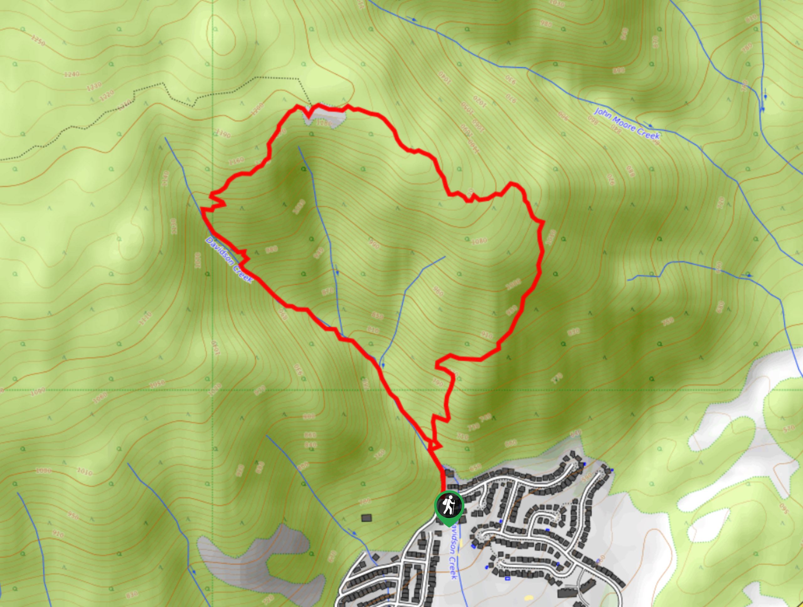
Carrot Mountain Loop
View Photos
Carrot Mountain Loop
Difficulty Rating:
The Carrot Mountain Loop near Kelowna, BC, is no easy feat! Prepare for an elevated heart rate, tricky route navigation, and some super steep sections, requiring poles and hiking boots. But what’s the best part about a challenging hike? The phenomenal views—and this hike provides entertainment throughout. Marvel at a waterfall, Shannon and Okanagan Lake from a bird’s eye view, and Kelowna!
Getting there
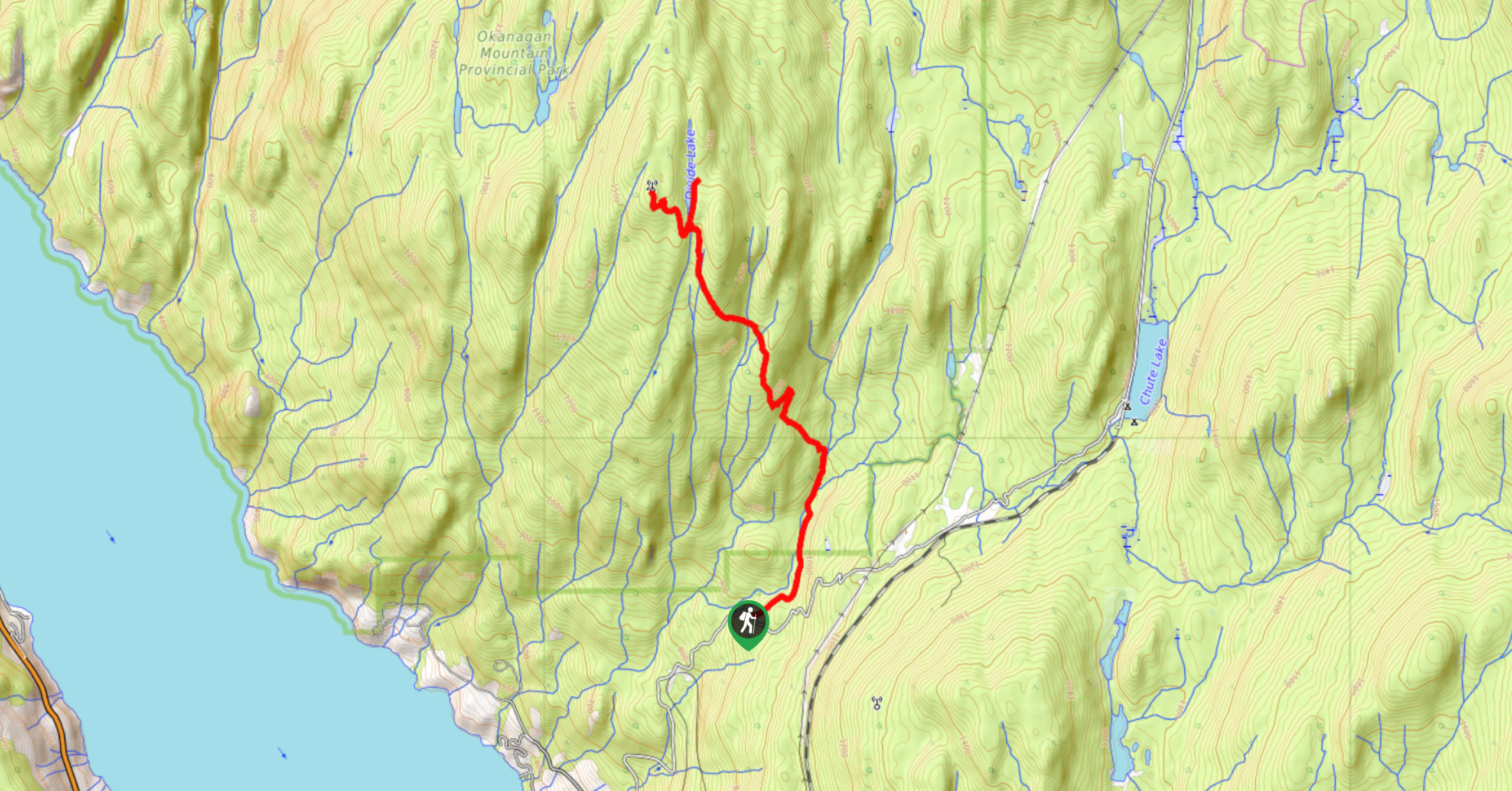
To get to Carrot Mountain Loop, make your way to Harvey Ave/Okanagan Hwy/BC-97 S. Follow this road for 5.2mi before turning right onto Bartley Road. After 1148ft, take a left onto Shannon Road and then a right onto Shannon Woods Drive, followed by a quick right onto Shannon Hills Drive. After 820ft, take a left onto Shannon Heights Place, which veers slightly left, becoming Paramount Drive. You’ll see the Carrot Mountain trailhead shortly after the road veers left.

About
| When to do | May - October |
| Backcountry Campsites | No |
| Pets allowed | Yes - On Leash |
| Family friendly | No |
| Route Signage | Poor |
| Crowd Levels | Low |
| Route Type | Circuit |
Carrot Mountain Loop
Elevation Graph
Weather
Carrot Mountain Loop Description
The Carrot Mountain Loop in the Okanagan Valley is a challenging but rewarding hike. It’s best only to attempt this hike during the summer months when it’s easier to see the carved-out trail. Doing this hike in winter may result in you getting lost due to the lack of signage and isn’t recommended due to the steep and slippery conditions. To top it off, you’ll need poles and hiking boots to navigate the rough terrain, no matter when you do this hike. Casual runners may result in injuries!
Some hikers opt to turn around at the summit, where the Canadian flag flutters (which needs replacing), and you’ll get a chance to catch your breath and marvel at the view of Okanagan Lake tucked into the valley below. The out-and-back version gives you a chance to amp up your heart rate as the elevation is steep from the trailhead until the summit! However, if you aren’t a fan of retracing your steps and winding past views (and, in this case, a waterfall) that you just saw, take the loop option. Do know that this loop’s descent is technically exhausting and difficult to follow, so bring a GPS along with you!
Similar hikes to the Carrot Mountain Loop hike
Okanagan Mountain Hike
The Okanagan Mountain Hike is an incredible backcountry hike that gets your heart pumping, unveiling a reel of views en…
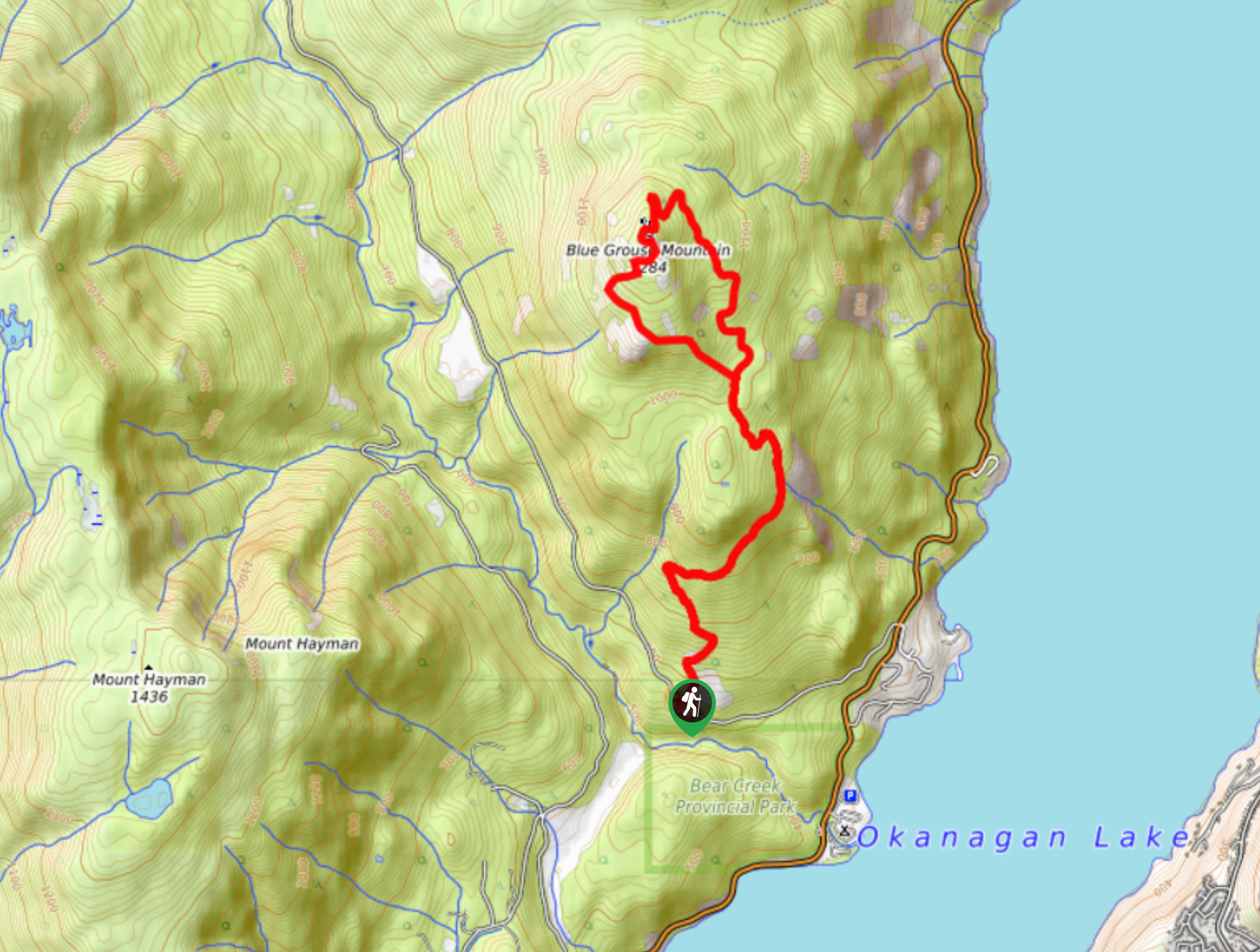
Blue Grouse Mountain Hike
The Blue Grouse Mountain Hike near Kelowna, BC, is a challenging hike that carries you up a steep ascent to…
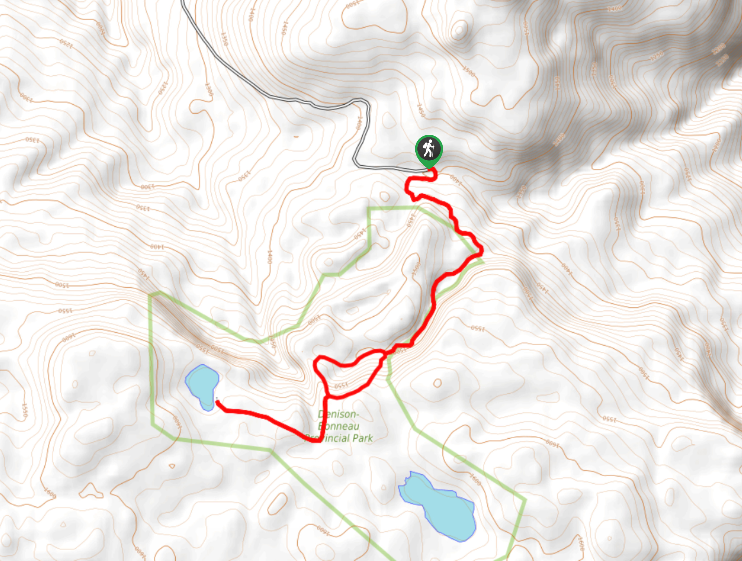
Denison Lake Trail
When summer rolls around, the Okanagan Valley’s scorching hot weather propels most to flock to the beaches, but why not…
Comments