
Columbia Trail
View Photos
Columbia Trail
Difficulty Rating:
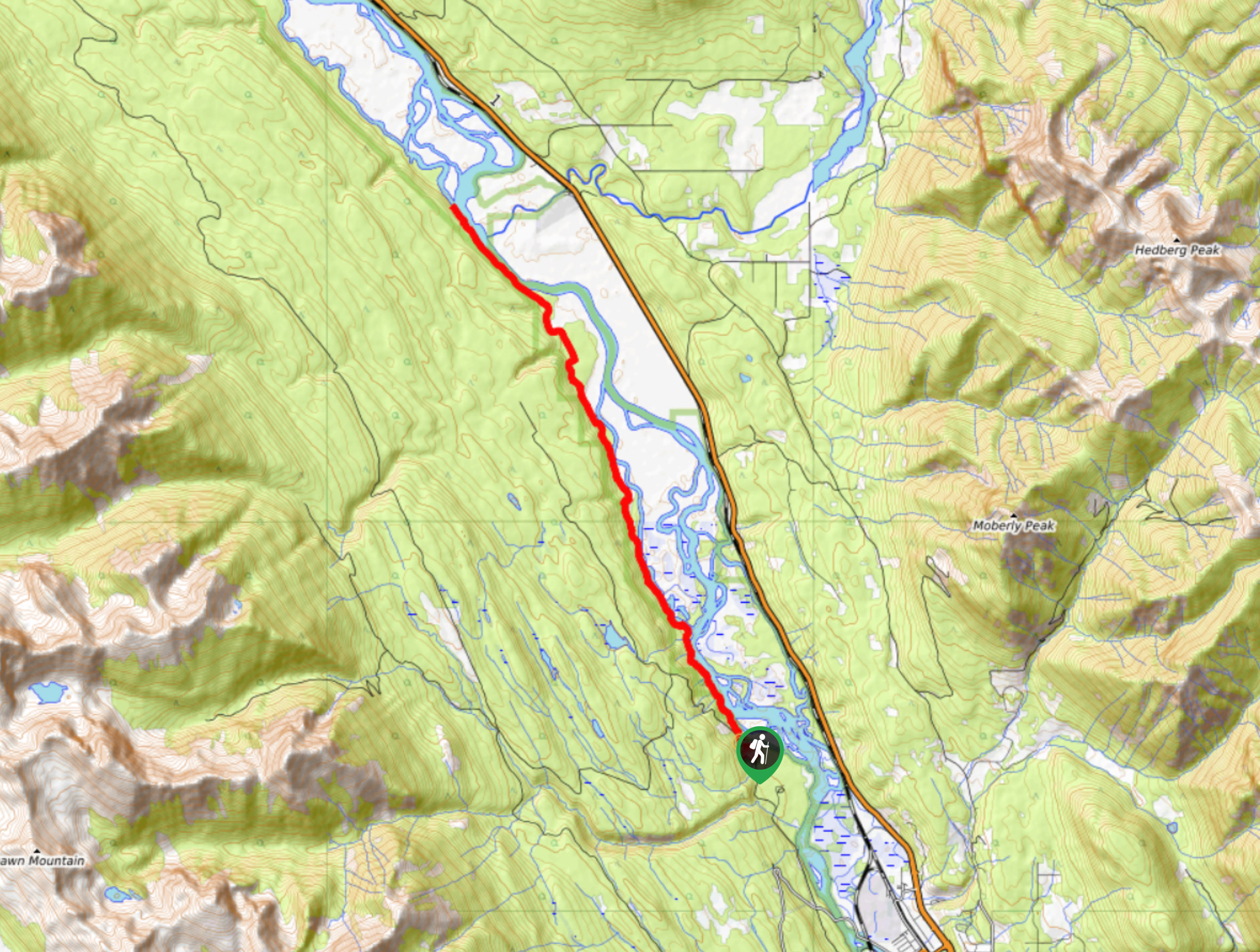
The Columbia Trail is a lengthy 14.9mi out-and-back trail that can be found near Golden, BC, and stretches north alongside the flowing waters of the Columbia River. Hikers along this trail will experience incredible views from within the valley of neighbouring mountain peaks and the tranquil riverside atmosphere. This is a long route, so make sure to bring lots of water and snacks for the journey.
Getting there
To get to the parking area for the Columbia Trail from Golden, head northwest on Kicking Horse Drive for 1.1mi and turn right onto Golf Course Drive. After 1.2mi, turn left, and you will find the parking area on the left in 0.9mi. The trailhead can be located across the road.

About
| When to do | May-October |
| Backcountry Campsites | No |
| Pets allowed | Yes - On Leash |
| Family friendly | No |
| Route Signage | Average |
| Crowd Levels | Low |
| Route Type | Out and back |
Columbia Trail
Elevation Graph
Weather
Columbia Trail Description
Hiking along the Columbia Trail is a lengthy but rewarding experience that will take you through Burges & James Gadsden Provincial Park on a route that closely follows the western shore of the Columbia River. While out on the trail, you will be able to take in the scenic views of the riverside as the flowing waters of the mighty river cut through the valley and are framed by the towering mountain peaks above.
The route offers a nice mix of forest and wetland terrain, through which you will be able to spot numerous wildlife species that inhabit each type of landscape. While there is a moderate elevation gain of 2464ft, this is spread mainly throughout the hike, meaning that the real obstacle of this route is the long distance as opposed to any particularly difficult terrain. This route is perfect for hikers looking for a long day out on the trails reconnecting with nature.
Similar hikes to the Columbia Trail hike
Mount 7 Trail
The Mount 7 Trail is a 5.6mi out-and-back hiking route near Golden, BC, that sets out from a…
Upper Certainty Mine Trail
The Upper Certainty Mine Trail is a 1.9mi out-and-back hiking route that will take you through some beautiful…
Lower Certainty Mine Trail
The Lower Certainty Mine Trail is a 6.0mi out-and-back hiking route near Golden, BC, that climbs through the…
Comments