

5040 Peak
View Photos5040 Peak
Difficulty Rating:
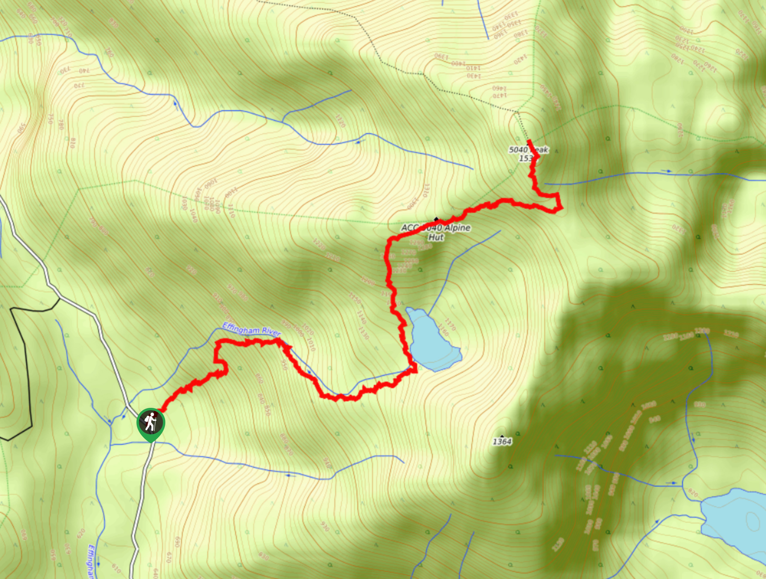
The trek up 5040 Peak is a 4.3mi out-and-back hiking route that will lead you uphill past the serene shores of Cobalt Lake for some breathtaking views across the rugged Vancouver Island landscape. While out on the trail, hikers will experience beautiful forest scenery, charming waterfalls, and stunning alpine views as they work their way alongside the Effingham River towards the rugged summit. Pair this hike with an overnight stay in the ACC 5040 Alpine Hut for a memorable experience up in the mountains.
Getting there
To reach the 5040 Peak trailhead from Tofino, drive southeast on BC-4 for 19.5mi and turn left to continue on the highway. After 25.4mi, turn right and continue for 8.0mi to find the trailhead on the left.
About
| When to do | May–October |
| Mountain Huts | ACC 5040 Alpine Hut |
| Pets allowed | Yes - On Leash |
| Family friendly | No |
| Route Signage | Average |
| Crowd Levels | Low |
| Route Type | Out and back |
5040 Peak
Elevation Graph
Weather
5040 Peak Trail Description
The 5040 Peak Trail is a tough uphill hiking route that is sure to feel like a grind at times, but the breathtaking views from the summit will be more than worth the effort. The drive into the trailhead is pretty rough and would be easier with a 4×4 vehicle. But, it’s not completely necessary, and hikers with a regular vehicle with high enough clearance can also make the trip given enough time. Remember to bring bear spray and make plenty of noise while out hiking on this trail as animals roam the area.
Setting out from the trailhead, make your way into the dense cover of the forest and begin your journey to the summit of 5040 Peak. This initial stretch of the trail is relatively steep and rooty, but after 0.6mi, it will level out as you pass by a scenic lookout point and hike along Effingham River on the approach to Cobalt Lake. When you reach the scenic shores of the lake, follow the trail to the north as it crosses over the river and skirts along the western shore. Admire the surreal views across the calm water of the lake with the rugged backdrop of the alpine basin before starting your climb through the alpine on your ascent to the summit.
Shortly after the trail turns to the east, you will arrive at the ACC 5040 Alpine Hut, which you can book to spend an unforgettable night in the mountains with breathtaking views surrounding you in every direction. Continue pushing your way up to rocky terrain towards the summit, where you will be greeted by panoramic views of the rugged Vancouver Island landscape. Look for the mountain peaks such as Nahmint Mountain to the east and Triple Peak to the south. After taking in the views, head back down along the trail and hop into the chilly waters of Cobalt Lake for a quick refreshing dip before returning to the trailhead where you began your hike.
Similar hikes to the 5040 Peak hike

Radar Beach Trail
The Radar Beach Trail is a 1.3mi out-and-back route near Tofino that sets out from the top of…

Lone Cone Trail
The Lone Cone Trail is a 3.6mi hiking route on Meares Island that can only be reached by…

Canso Crash Site Trail
The Canso Crash Site Trail is a 3.2mi out-and-back hiking route south of Tofino that traverses various terrain…


Comments